Earthquake Source Model Database
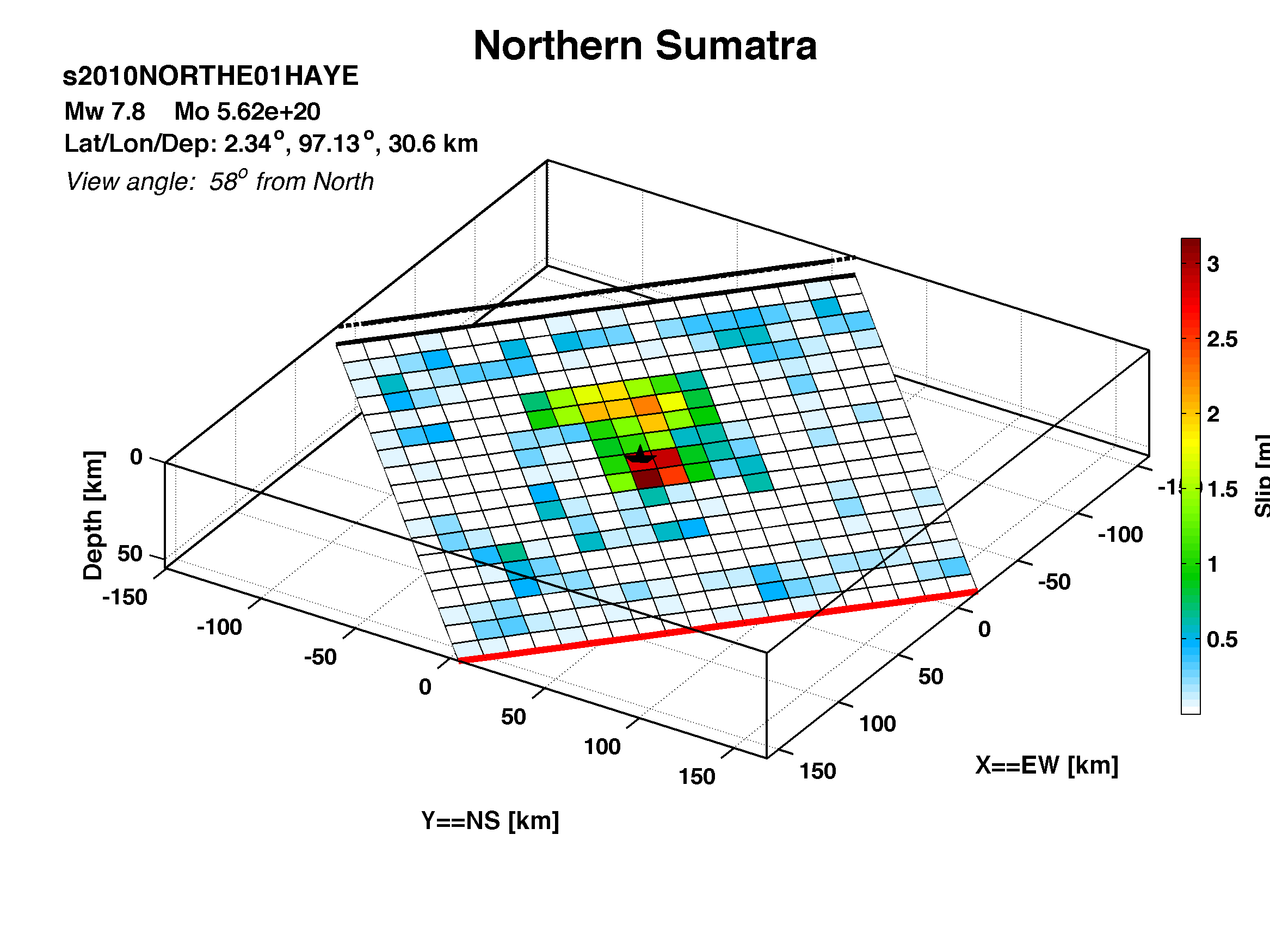
Model/Event tag: s2010NORTHE01HAYE
Event
| Author | Location | Date | Latitude (°N) | Longitude (°E) | Depth (km) | Flinn-Engdahl region |
| Hayes (USGS, Northern Sumatra 2010) | Northern Sumatra | Apr 06, 2010 | 2.3384 | 97.1331 | 30.64 | Northern Sumatra, Indonesia |
Source parameters
| Magnitude (Mw) |
Seismic moment (Nm) |
Strike (°) |
Dip (°) |
Rake (°) |
Length (km) |
Width (km) |
Htop (km) |
Hypocenter (km) | Avg rise time (s) |
Avg rupture speed (km/s) |
|
| x | z | ||||||||||
| 7.80 | 5.62E+20 | 312.70 | 12.04 | 90.09 | 240.00 | 216.00 | 9.37 | 114.00 | 102.00 | 999.00 | 999.00 |
Data source: Downloaded from publicly accessible website.