Earthquake Source Model Database
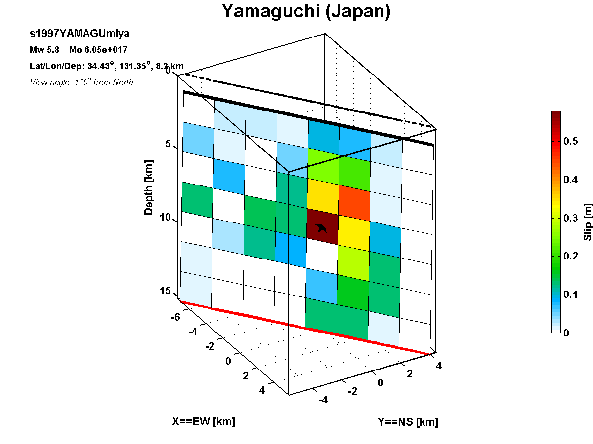
Model/Event tag: s1997YAMAGU01MIYA
Old event tag: s1997YAMAGUmiya
Event
| Author | Location | Date | Latitude (°N) | Longitude (°E) | Depth (km) | Flinn-Engdahl region |
| Miyakoshi et al. (2000) | Yamaguchi (Japan) | Jun 25, 1997 | 34.4300 | 131.6760 | 8.20 | Western Honshu, Japan |
Source parameters
| Magnitude (Mw) |
Seismic moment (Nm) |
Strike (°) |
Dip (°) |
Rake (°) |
Length (km) |
Width (km) |
Htop (km) |
Hypocenter (km) | Avg rise time (s) |
Avg rupture speed (km/s) |
|
| x | z | ||||||||||
| 5.82 | 6.05E+17 | 53.00 | 88.00 | 148.71 | 16.00 | 14.00 | 1.20 | 9.00 | 7.00 | 0.75 | 2.50 |
Data source: To be updated.