Location
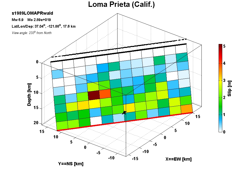
| Latitude | Longitude | Depth [km] | Date [dd mm yyyy] | Flynn-Engdahl Region |
| 37.04 | -121.88 | 17.60 | 18 / 10 / 1989 | Central California, United States |
Source Parameters
| Magnitude Mw | M0 [Nm] | Strike [deg] | Dip [deg] | Rake [deg] | Length [km] | Width [km] | Rise time [s] | Rupture speed [km/s] |
| 6.94 | 2.89e+019 | 128.00 | 70.00 | 136.00 | 40 | 20 | 1.900 | 2.7 |
Inversion
| Author | Data | Grid | inversion time windows | ||||||||||
| SGM | Tele | GPS | Insar | Tril/Level | other | Number of segments | general dz dx | slip velocity function | number | length [s] | overlap [s] | ||
| Wald etal (1991) | x | x | - | - | - | - | 1 | 2.5 | 3.3 | triangle | 3 | 0.70 | 0.10 |
Downloads
| Event tag | slip distribution (ascii) | finite source parameters (ascii) | matlab file | matlab figure | additional information |
| s1989LOMAPRwald | s1989LOMAPRwald.slp | s1989LOMAPRwald.fsp | s1989LOMAPRwald.mat | s1989LOMAPRwald.fig | s1989LOMAPRwald_add |
Last Update: 21 Jul 2007/ fb - Created: 2007 / fb close this window