Location
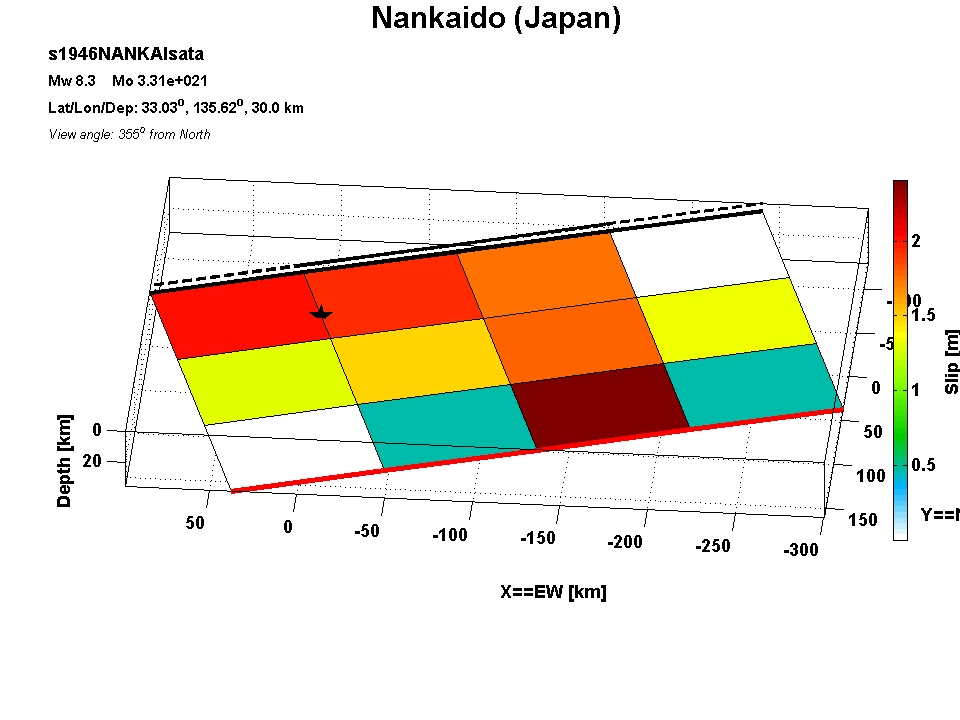
| Latitude | Longitude | Depth [km] | Date [dd mm yyyy] | Flynn-Engdahl Region |
| 33.03 | 135.62 | 30.00 | 20 / 12 / 1946 | Near south coast of western Honshu, Japan |
Source Parameters
| Magnitude Mw | M0 [Nm] | Strike [deg] | Dip [deg] | Rake [deg] | Length [km] | Width [km] | Rise time [s] | Rupture speed [km/s] |
| 8.31 | 3.31e+021 | 250.00 | 10.00 | 120.00 | 360 | 180 | 0.000 | 0 |
Inversion
| Author | Data | Grid | inversion time windows | ||||||||||
| SGM | Tele | GPS | Insar | Tril/Level | other | Number of segments | general dz dx | slip velocity function | number | length [s] | overlap [s] | ||
| Satake (1993) | - | - | - | - | x | x | 1 | 60 | 90 | geodetic_model | 0 | ||
Downloads
| Event tag | slip distribution (ascii) | finite source parameters (ascii) | matlab file | matlab figure | additional information |
| s1946NANKAIsata | s1946NANKAIsata.slp | s1946NANKAIsata.fsp | s1946NANKAIsata.mat | s1946NANKAIsata.fig | s1946NANKAIsata_add |
Last Update: 21 Jul 2007/ fb - Created: 2007 / fb close this window