Earthquake Source Model Database
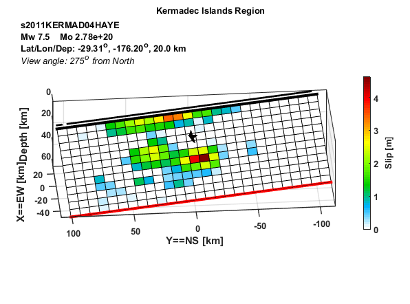
Model/Event tag: s2011KERMAD04HAYE
Event
| Author | Location | Date | Latitude (°N) | Longitude (°E) | Depth (km) | Flinn-Engdahl region |
| Hayes (2017) | Kermadec Islands | Jul 06, 2011 | -29.3120 | -176.2040 | 20.00 | Kermadec Islands Region |
Source parameters
| Magnitude (Mw) |
Seismic moment (Nm) |
Strike (°) |
Dip (°) |
Rake (°) |
Length (km) |
Width (km) |
Htop (km) |
Hypocenter (km) | Avg rise time (s) |
Avg rupture speed (km/s) |
|
| x | z | ||||||||||
| 7.55 | 2.78E+20 | 169.65 | 52.49 | -99.81 | 216.00 | 72.00 | 3.34 | 108.00 | 21.00 | 2.52 | 1.26 |
Data source: Obtained electronically from the author.