Earthquake Source Model Database
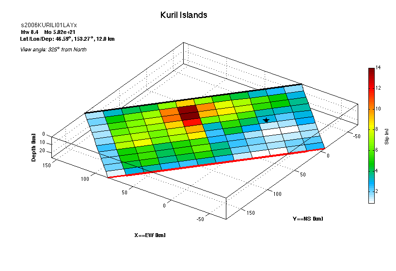
Model/Event tag: s2006KURILI01LAYx
Event
| Author | Location | Date | Latitude (°N) | Longitude (°E) | Depth (km) | Flinn-Engdahl region |
| Lay et al. (2009) | Kuril Islands | Nov 15, 2006 | 46.5920 | 153.2660 | 12.00 | Kuril Islands |
Source parameters
| Magnitude (Mw) |
Seismic moment (Nm) |
Strike (°) |
Dip (°) |
Rake (°) |
Length (km) |
Width (km) |
Htop (km) |
Hypocenter (km) | Avg rise time (s) |
Avg rupture speed (km/s) |
|
| x | z | ||||||||||
| 8.40 | 5.02E+21 | 220.00 | 15.00 | 96.75 | 240.00 | 100.00 | 0.35 | 188.74 | 47.63 | 999.00 | 999.00 |
Data source: Obtained electronically from the author.